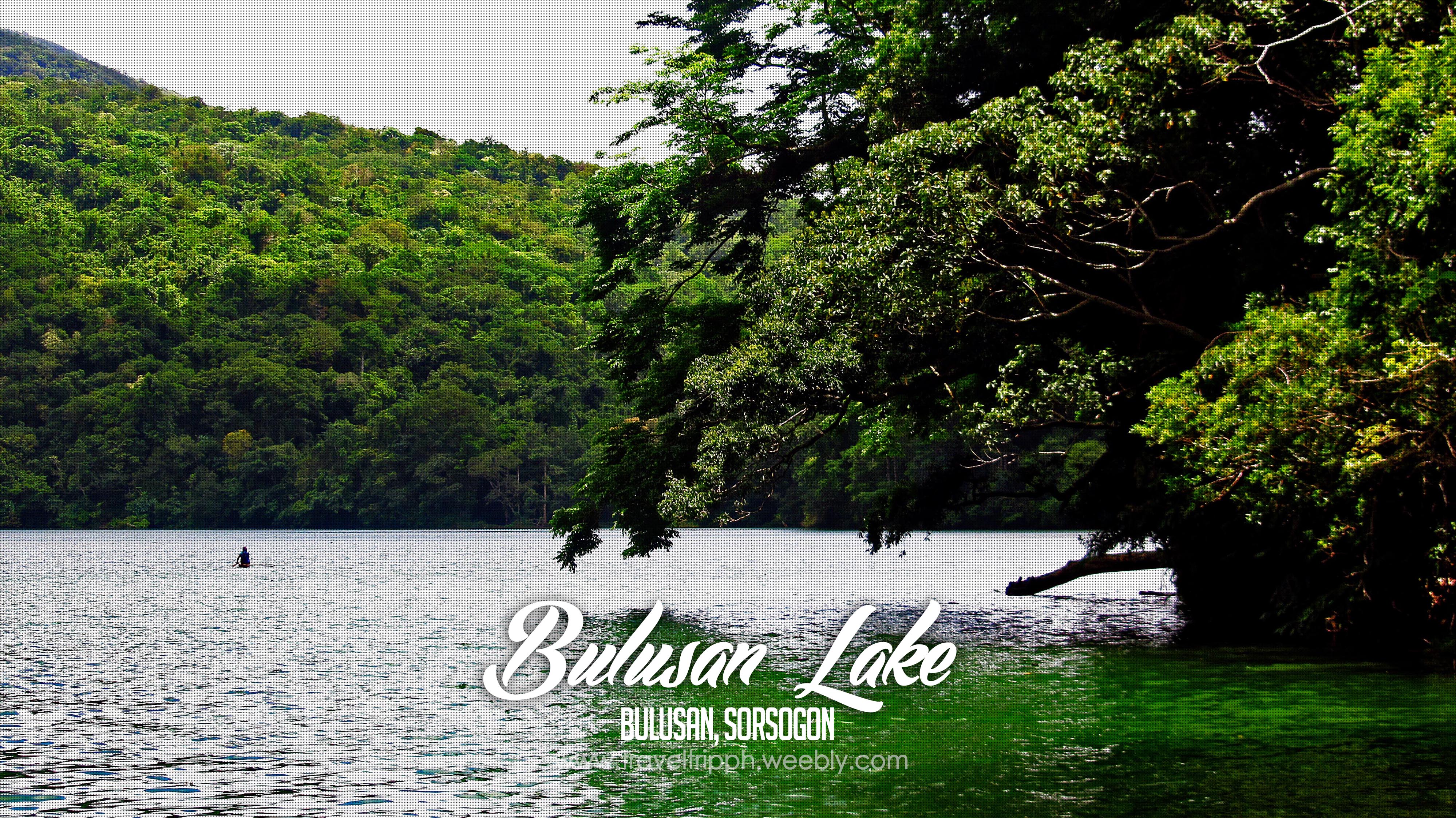
At the heart of Bulusan Volcano Natural Park lies an emerald green flaccid water of the Bulusan Lake. The serenity of the lake and the vast rich vegetation of different species of plants, orchids, ferns plus the endemic species of birds, mammals, reptiles, insects and freshwater fish just complete the rich flora and fauna collection of the reserved National Park.
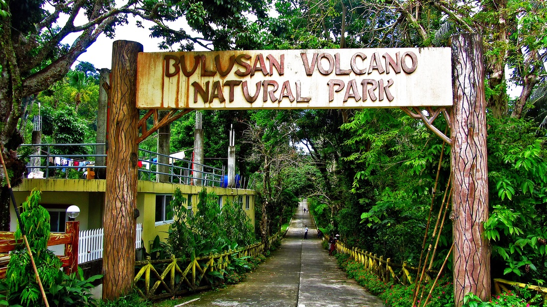
The Natural Park is a 3,673 hectare of protected area of rainforest surrounding the one of the most active volcano in the country the Mount Bulusan. The park is located at the south central part of the province and is confined by five towns such as Bulusan, Barcelona, Irosin, Juban and Casiguran.
There are three main peak in the reserve area, the first is the active Mt. Bulusan which was the highest and is characterized by numerous deep ravines and caves. The second is the mountain called Hormahan which is a sharp peak. Lastly was the Lake Aguingay, it is the center of the mountain complex forms, and is a vast plain that is occasionally flooded during wet seasons but dries up during summer season.
There are three main peak in the reserve area, the first is the active Mt. Bulusan which was the highest and is characterized by numerous deep ravines and caves. The second is the mountain called Hormahan which is a sharp peak. Lastly was the Lake Aguingay, it is the center of the mountain complex forms, and is a vast plain that is occasionally flooded during wet seasons but dries up during summer season.
It is home to fauna like the Philippine baboon, hawks, monitor lizards, various endemic frogs, snakes and other reptiles. Some say that once there were deer but none has been sighted since the 1980s. The park supports the needs of its communities through its forest products, watershed and recreational values. Residents the lower slopes as agricultural land.
But the main attraction in the forest reserve is the Lake Bulusan which was located on the south eastern flank of Mount Bulusan. It has an elevation of 360 meters above sea level and was said to be formed by tectonic damming and was perhaps another crater of a volcano. It has emerald green water with a depth of up to 20 meters (~60 feet) deep and its waterbed is rocky, sandy and muddy in other parts.
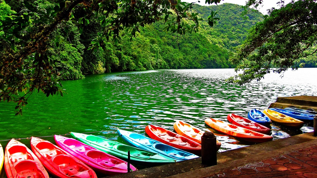
There are cottages that are good for picnics near the entrance of the lake and you can also try kayaking for the rate of P125 per person. There is also a cemented path that can give you the other view of the lake and mind you guys as you started walking and entering you will feel what is it like to be in a rainforest. The chirping of different bird species is echoing the whole park. There was also different colors and sizes of butterflies that roams around the lake.
There are cottages that are good for picnics near the entrance of the lake and you can also try kayaking for the rate of P125 per person. There is also a cemented path that can give you the other view of the lake and mind you guys as you started walking and entering you will feel what is it like to be in a rainforest. The chirping of different bird species is echoing the whole park. There was also different colors and sizes of butterflies that roams around the lake.
The lake is accessible either through the Maharlika Highway up to the town of Irosin through the towns of Casiguran and Juban. From Irosin, the landmark that you must remember is the letter “I” it is another ten kilometres to the site.
During our travel trip since we have a service van we took the very scenic route overlooking the Pacific Ocean like the town of Gubat that is famous for their Rizal Beach and the town of Barcelona wherein you can took a good jump shot in their town’s marker plus the century old church.
During our travel trip since we have a service van we took the very scenic route overlooking the Pacific Ocean like the town of Gubat that is famous for their Rizal Beach and the town of Barcelona wherein you can took a good jump shot in their town’s marker plus the century old church.


 RSS Feed
